
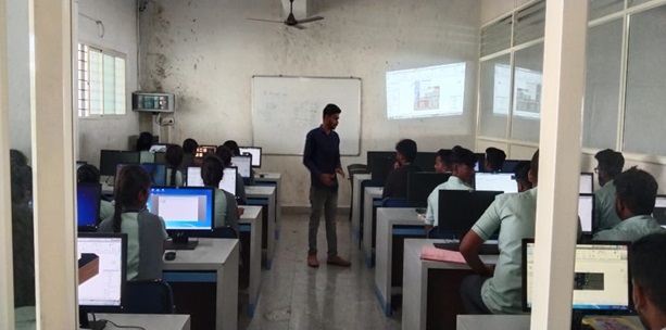
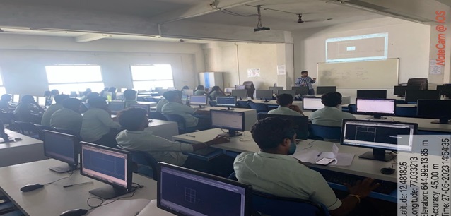
1. Certification Training
To enhance the skill set of students and improve their employability, we have developed an initiative to offer 7 industry-recognized Certification Courses during the course of their degree program. This initiative aims to equip students with both skill-based and job-oriented competencies through partnerships with reputed training organizations. Each certification program will include a minimum of 40 hours of training, conducted during weekends within the semester. The training structure will consist of:
- Comprehensive course instruction
- Hands-on practical sessions
- Project implementation
- End-of-course assessment and certification
Upon successful completion of all seven certifications by the end of their graduation, students will be fully industry-ready, possessing multiple skills that are aligned with current market demands. This structured multi-certification approach ensures that every student graduates with 7 recognized, job-oriented, skill-based certifications, increasing their readiness for employment and career advancement.
| Semester. | Course |
| 1. | Inunity |
| 2. | AutoCAD |
| 3. | Google Sketchup |
| 4. | ETABS |
| 5. | GIS |
| 6. | Revit |
| 7. | TEKLA |
1. Inunity: By Innovation for community - Co-ordinated by Mrs. Niveditha K M
The program aims to ensure that every student graduates with strong, industry-ready capabilities by developing practical technical skills, hands-on project experience, and job-oriented competencies through seven professional certification courses. Students will be able to apply real-world problem-solving techniques, work effectively in teams, communicate their ideas clearly, and demonstrate professionalism and workplace readiness. By completing certified training from reputed organizations and building a strong project portfolio, students will be well-prepared for internships and employment opportunities in their chosen career paths.

2. AutoCAD- Google Sketchup – By CRP-CAED Institute- Co-ordinated by Mr. Abhisheka L
Upon completion of the AutoCAD certification, students will be able to create accurate 2D drawings and basic 3D models using industry-standard drafting techniques. They will develop the ability to interpret engineering drawings, apply precise dimensions, layers, and annotation tools, and produce professional-quality technical designs. Students will also gain hands-on experience in real-time drafting projects, enabling them to understand design standards and workflow practices used in engineering and architectural industries. By the end of the course, learners will be capable of independently preparing detailed CAD drawings and contributing effectively to design and drafting tasks in professional environments. Students will be able to confidently navigate the SketchUp workspace, use essential modeling tools to create accurate 2D and 3D designs, apply materials and textures, organize models using groups, components, and tags, and generate clear visual presentations using scenes, styles, and animations. They will demonstrate the ability to solve design problems through effective modeling techniques, produce scaled architectural or product designs, and export their work in appropriate formats for presentation, collaboration, or further development.
3. ETABS- GIS- CRP-CAED Institute- Co-ordinated by Mr. Santhosh M C
By the end of the course, students will be able to confidently use ETABS to model, analyze, and design structural systems with accuracy and efficiency. They will demonstrate the ability to create detailed structural models, assign material properties and load conditions, interpret analysis results, and apply relevant design codes to evaluate structural performance. Students will also be able to identify structural issues, optimize design solutions, and prepare clear analytical outputs and documentation suitable for professional engineering practice. By the end of the course, students will be able to effectively use Geographic Information Systems (GIS) to collect, manage, analyze, and visualize spatial data for real-world applications. They will demonstrate the ability to interpret geospatial patterns, create accurate thematic maps, utilize geoprocessing tools, and integrate multiple data sources to support decision-making in environmental, urban, engineering, and resource-management projects. Students will also be able to communicate geospatial findings clearly through well-designed maps and reports that meet professional standards.
4. Revit- TEKLA- CRP-CAED Institute-Co-ordinated by Mr. Mahadeva C K
By the end of the course, students will be able to proficiently use Revit to create accurate Building Information Models (BIM) that include architectural components, structural elements, and building systems. They will demonstrate the ability to produce coordinated 2D drawings and 3D models, manage views and sheets, apply materials and parameters, and collaborate within a shared project environment. Students will also be able to analyze building performance, detect design conflicts, and generate professional documentation that supports efficient design, visualization, and project delivery. By the end of the course, students will be able to effectively use Tekla Structures to create detailed and accurate 3D models for steel and concrete structures, applying industry-standard practices in constructability and fabrication modeling. They will demonstrate the ability to generate shop drawings, reports, and material lists; manage connections and component libraries; and coordinate models within a multi-disciplinary workflow. Students will also be able to detect clashes, ensure model accuracy, and prepare complete, construction-ready documentation that supports efficient project planning and execution.
